Dronas.lt

DJI Enterprise · Software

DJI Terra

Mapping software: 2D/3D reconstruction from imagery, LiDAR data processing, 3D Gaussian Splatting and thermal maps with temperature measurement.
Price on request
Licences – via official DJI dealers
Licensing · Training · Technical support
About the product

Description

DJI Terra is DJI software for turning drone-collected data into 2D and 3D outputs: photogrammetry from images, DJI LiDAR point clouds, 3D Gaussian Splatting and multispectral reconstruction. The latest version 5.3.0 (August 2026) adds a thermal map, reconstruction from video, higher accuracy with rolling shutter images and an AI assistant. Key capabilities are listed below.
01

Thermal 2D map with temperature measurement (5.3.0)

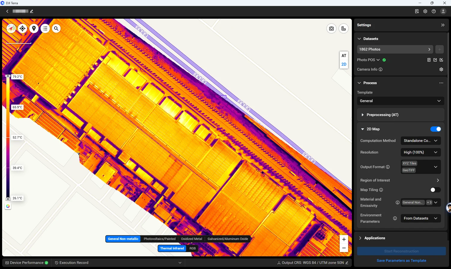
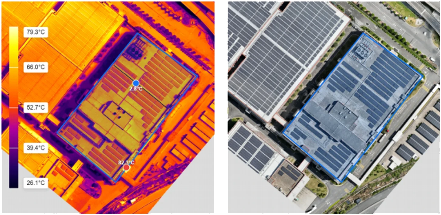
Aerial triangulation is performed on visible-light images and the results applied to thermal images, producing a heat map. You can set material emissivity, measure temperature at points, lines and areas, choose from 10 colour palettes and export a report in xlsx or PDF. Suitable for inspecting solar plants, factory roofs, fuel tanks and fire safety; Mavic 3T, Matrice 3TD, Matrice 4TD, Zenmuse H20T, H20N and H30T are supported.
DJI Terra
DJI Terra
02

Reconstruction from video and rolling shutter accuracy

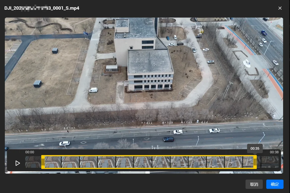
Frames can be extracted from video (MP4 / ts, GPS information required) for 2D / 3D reconstruction. A new high-accuracy mode is designed for rolling shutter images from Matrice 4T, Matrice 3TD and Matrice 4TD: with a stable RTK signal, horizontal accuracy reaches about 3–4 GSD and vertical 4–5 GSD.
03

3D Gaussian Splatting and cluster processing

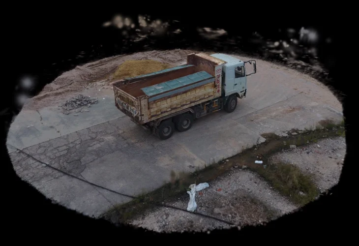
Photorealistic 3D Gaussian Splatting models have been available since version 5.0.0, and in 5.3.0 they can be processed on a cluster – so large projects are computed faster. Results can be exported in TerraGS, PLY and 3DTiles formats, together with a GeoTIFF orthophoto.
DJI Terra
DJI Terra
04

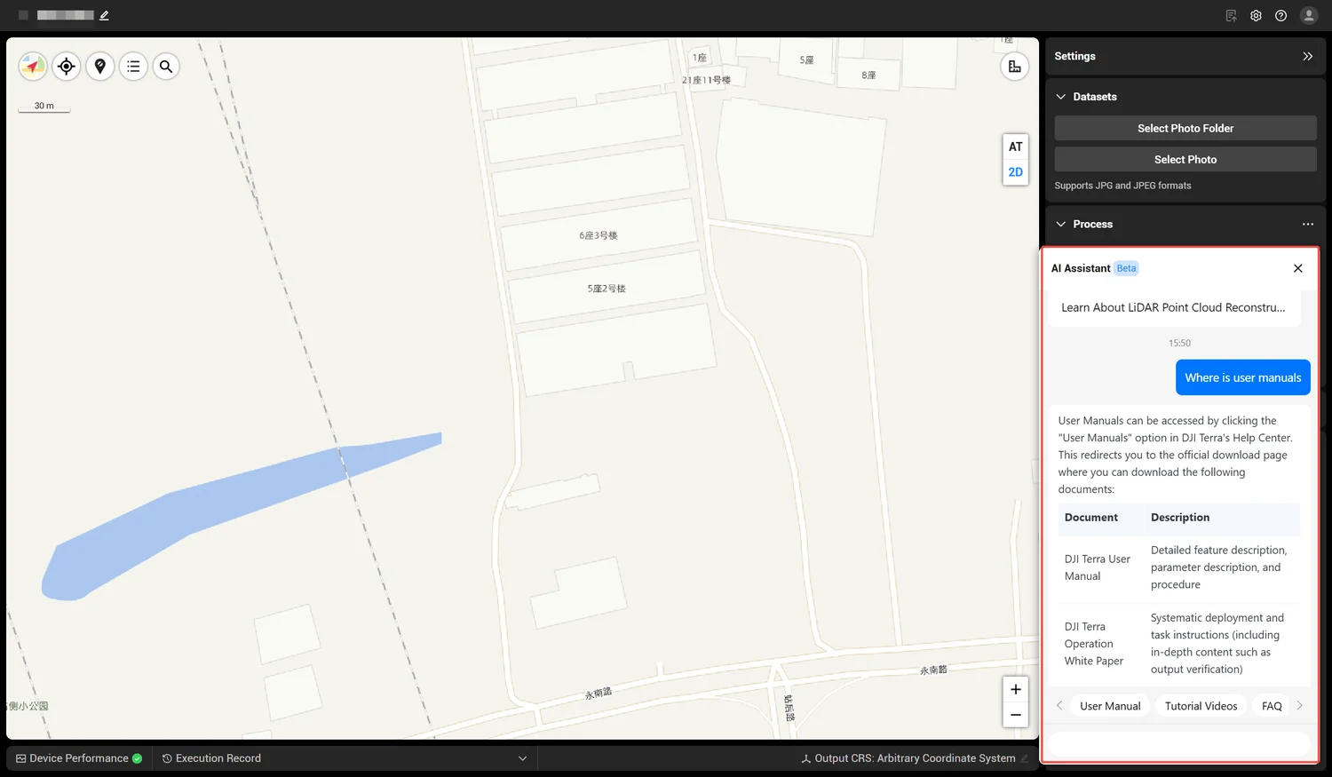
AI assistant, execution log and coordinate systems

The software includes an AI assistant (internet connection required), and the execution log panel helps quickly find the causes of processing errors. Local elevation TIFF files in GTG format are supported, and the latest geoid models (e.g. KNGeoid26) allow work with local height systems.
05

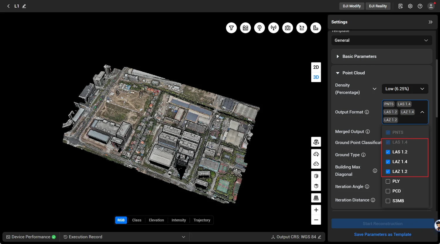
LiDAR point clouds: LAS 1.4 and LAZ 1.4

DJI LiDAR data processing, classification and quality reports. Point clouds are exported in LAS 1.4 / LAZ 1.4 formats, making them easy to transfer to other surveying or CAD software.
DJI Terra
Terra is distributed through official DJI dealers (Standard and Flagship editions). We help you choose the right edition, install it and train you to use the software. The official trial lasts one month and has limits: no more than 500 images per reconstruction, LiDAR data up to 8 GB.
Specifications
Reconstruction
2D and 3D from visible-light images (photogrammetry)
LiDAR
DJI LiDAR data processing, point clouds LAS 1.4 / LAZ 1.4
3D Gaussian Splatting
TerraGS, PLY and 3DTiles output; GeoTIFF orthophoto included
Thermal map (5.3.0)
Mavic 3T, Matrice 3TD, Matrice 4TD, Zenmuse H20T / H20N / H30T; temperature measurement at points, lines and areas, report xlsx / PDF
Multispectral
Multispectral reconstruction for agriculture
Cluster
Cluster processing, including Gaussian Splatting
Video
Reconstruction from video frames (MP4 / ts), GPS information required
Editions
Standard and Flagship (via official DJI dealers)
Latest version
5.3.0 (August 2026)
Video

Our webinars and reviews

Processing Zenmuse L2 data with DJI Terra

Source: our YouTube channel “GeoNovus – Trimble Lietuvoje”. The video loads only after you press “Play”.
Why Dronas.lt

Licensing and installation

We help you purchase a licence and get the software running.

Software training

We will teach you how to use the software.

Technical support

Help whenever questions or issues arise.
We can process your data for you.
Enquiry

Get a quote

Write to us — we will get in touch, confirm the configuration and send a commercial offer. No advance payment required.
DJI FlightHub 2
Product
DJI Terra
What happens next
1
We will contact you within 1 business day
2
We will discuss and confirm the configuration
3
We will send a commercial offer
Related products

You may also like

DJI FlightHub 2
DJI Enterprise
Cloud drone management platform: remote control, flight planning, data analysis, automated workflows and integrations with third-party systems.
Price on request
DJI matrice 4T – vaizdas iš šono
DJI Enterprise
A thermal platform for when seeing heat matters: night-time search and rescue, thermal inspections of power lines and substations, solar plants and buildings. Six sensors, AI object recognition and up to 49 min flight time.
€6,890 incl. VAT
DJI matrice 4E – vaizdas iš šono
DJI Enterprise
Photogrammetry and mapping platform: RTK module, 3-direction orthophoto and 5-direction oblique capture, 0.5 s photo interval and up to 49 min flight time. For topography, construction, mining and 3D models.
€4,590 incl. VAT
Scroll to Top